Seismology
The TCS "Seismology"
builds on three existing European infrastructures to provide services for seismic
waveform data, earthquake parametric data and earthquake hazard data. These three
institutes at the origin of EPOS are ORFEUS
(Observatories & Research Facilities for European Seismology),
EMSC (European-Mediterranean Seismological Centre) and
EFEHR (European Facilities for Earthquake Hazard and Risk), respectively.
The Seismology-Gravimetry Department of the Royal Observatory of Belgium (ROB)
is a data provider to EPOS via the above European institutions. The provided data include:
- Digital seismic waveform data
- Historical macroseismic information
- Geological and paleoseismological knowledge on the main seismic faults in Belgium
1. Digital seismic waveform data
The ROB provides open access to seismic waveform data from the Belgian seismic
network to the seismological research community through the ORFEUS Data Centre (ODC),
one of the nodes within the European Integrated Data Archive (EIDA)
hosted by ORFEUS. ORFEUS is a non-profit foundation, with the ROB as a member
of its board of directors, that coordinates and promotes digital, broadband
seismology in the European-Mediterranean area. These high-precision data are used
for seismological studies at local, regional and world scales.
The ROB has maintained a modern seismic network since 1985 and
is the only Belgian agency that provides seismic data to ORFEUS (BE network,
code 1980).
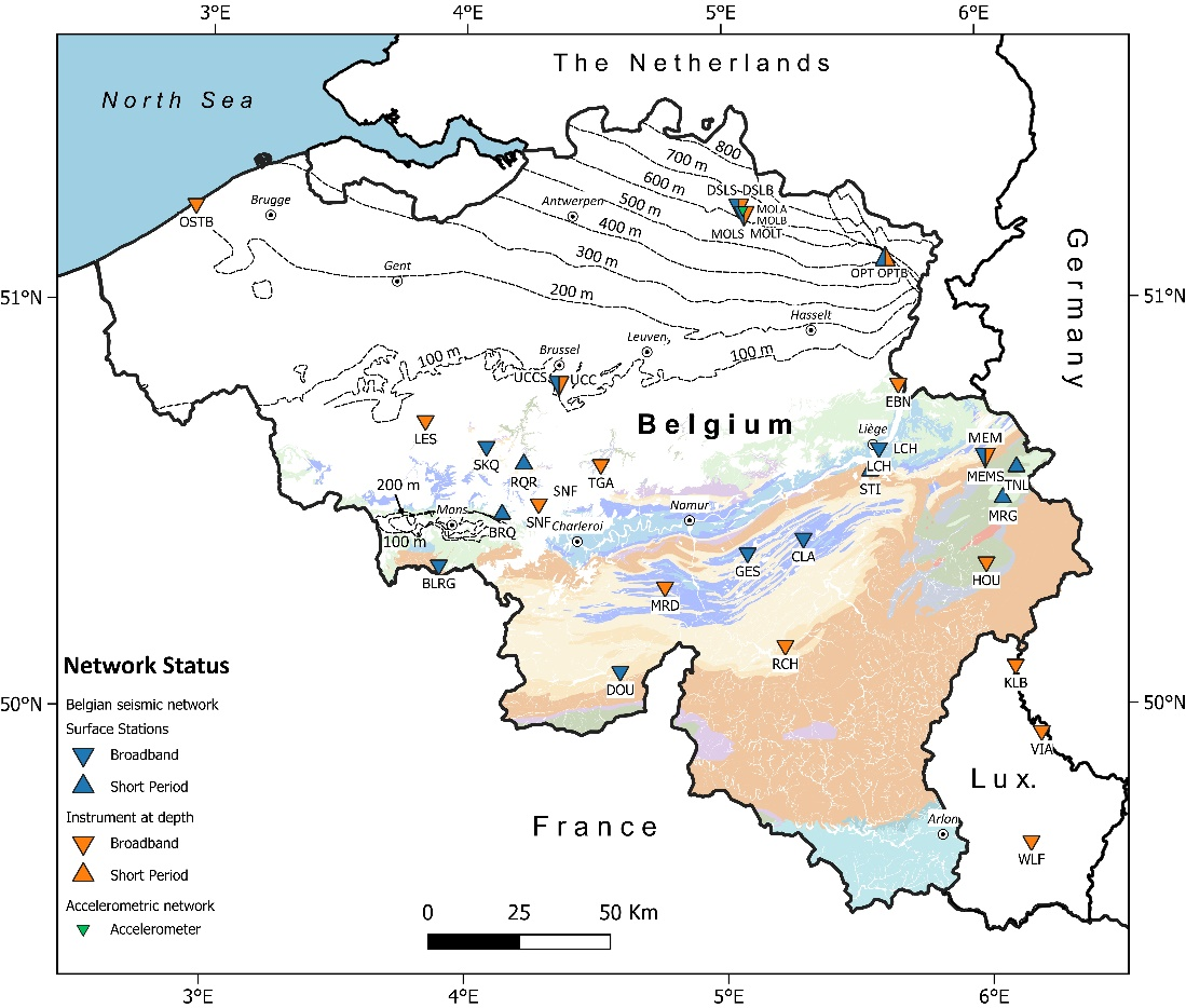
The permanent network consists of 28 measuring stations, of which ROB guarantees
the maintenance and data analysis. The permanent seismic network in Belgium
currently consists of two components: the seismometer network and the accelerometer network.
The seismometers make continuous recordings of ground vibrations
with a sensitivity tuned to detect even the lightest vibrations barely above the
noise level. In this way, they record seismic waves from local and global earthquakes.
The accelerometers are aimed at measuring strong ground motions
near epicenters. In addition to these permanent seismic stations, the ROB also used
mobile nodal systems for conducting short-term geophysical field array studies.
 Fig. 1. Overview of the Belgian seismic network.
Early 2019, ROB signed a Data Management Agreement between Seismic Network BE and ORFEUS
EIDA-node ODC. Currently, only seismic wave data from the 5 permanent seismometers
with broadband sensors are supplied to ORFEUS. These 5 seismometers are situated
at the Eben-Emael (BEBN), Oostende borehole (BOST), Membach (MEM), Opitter borehole (OPTB),
Rochefort cave (RCHB), and Uccle (UCC) stations. In the near future (2024), data streaming
to the EIDA node of ORFEUS will be extended to more than 10 key stations in the entire BE network.
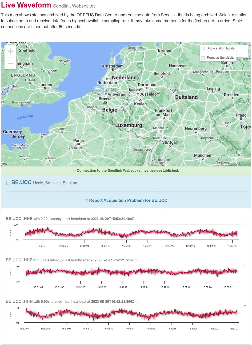
 Fig. 2. Example of digital seismic waveform data from the Uccle seismometer station,
as presented real-time by ORFEUS. Image source: https://www.orfeus-eu.org/data/odc/realtime/
The infrastructure of Belgian seismic network is constantly being improved and
kept to state-of-the-art quality standards. With the support of the
EPOS-BE project (2019-2023, BELSPO funded), 6 new broadband
seismometers (Nanometrics Trillium Compact Posthole 20 s combined with the
Centaur datalogger) were bought and installed recently, leading a clear data
quality improvement. In addition, the entire Belgian accelerometric network was
renewed (Nanometric Titan strong motion accelerometers). Finally, in the
EPOS-BE project, also a detailed site characterization of the entire seismic
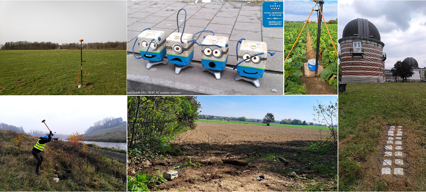
network was performed using new mobile nodal systems (SmartSolo® 3-component
(3C) 5 Hz geophones). Results provide detailed station velocity profiles that
provide Vs30 values listed in the
Orfeus Station books.
 Fig. 3. Site characterization of the Belgian seismic network using SmartSolo 3C seismic nodes.
2. Historical macroseismic information
From its own historical catalogue, ROB provides information on (pre-instrumental)
earthquakes on Belgian and European territory to the
AHEAD
(European Archive of Historical Earthquake Data) database. AHEAD, which is
coordinated and managed by Istituto Nazionale di Geofisica e Vulcanologia (INGV,
Italy), is an archive that preserves, inventories and disseminates historical
(1000-1899) data on the earthquake history of Europe. This data includes (1)
written accounts of earthquake effects, and (2) parameters such as earthquake
location, energy, etc. ROB is one of eight national research institutions across
Europe that supplies data to AHEAD.
Historical documentation can give considerable information on earthquakes that
occurred in the centuries prior to the advent of instrumental seismology. These
data are needed to estimate the magnitude of historical earthquakes. Based on
such estimates seismotectonic zonations, which characterize the seismic risk for
a certain region, can be defined. These maps are very important for earthquake
engineering as they indicate the most vulnerable regions to future earthquakes
of the same type.
3. Geological and paleoseismological knowledge on the main seismic faults in Belgium
ROB shares information on the main seismic faults in Belgium with the
ESDF
(European Database of Seismogenic Faults) database managed by EFEHR. The EDSF is
a repository that collects published geological and paleoseismological
information on seismically active faults in Europe. The database is limited to
faults that are deemed capable of generating earthquake of magnitudes > 5.5,
which in Belgium includes mainly faults in the Roer Valley Graben. The ESDF data
serve as input for earthquake hazard assessments.
